Maps - Current and Historic
I've always been a 'map freak.' I think my Grandson may have inherited that. This page is a collection of
maps, historic and current, of the region.
This page was augmented in November of 2019 by an even more
extensive list of historic maps of Northwest Indiana.
While my interest, in these pages, is historic maps of the region, a tremendous site for maps is AnyPlaceAmerica.com which has over 1.25 million water, land and man-made landmarks in the United States and a particularly good interface to them and USGS topographic maps. In particular, check out its page on Lake County. Or at AnyPlaceAmerica use your Zip Code in the Search box and then refine By Distance on the right.
Here’s the link to points within 5 miles of Zip Code 46403: https://www.anyplaceamerica.com/search/results.php?lat=41.61&lng=-87.26&distance=5&title=46403 (Accessed 5/13/2022)

Google Maps has always been my favorite. Clicking on the image will open a new window to Google Maps. Their map of these coordinates show, in light green, the park land that surrounds Miller Beach, from the National Lakeshore on the east, west through Miller in a corridor that is just under 1000 feet, to Miller Woods west of Lake Street. This corridor features a lenght of crushed limestone path that is part of the Calumet trail. Unfortunately it stops at Grand Boulevard even though there's a very nice bridge there. (Don't ask - why the path, which follows the old rail road right-of-way, isn't complete, is a mystery wrapped up in some lawyer's drawer.)
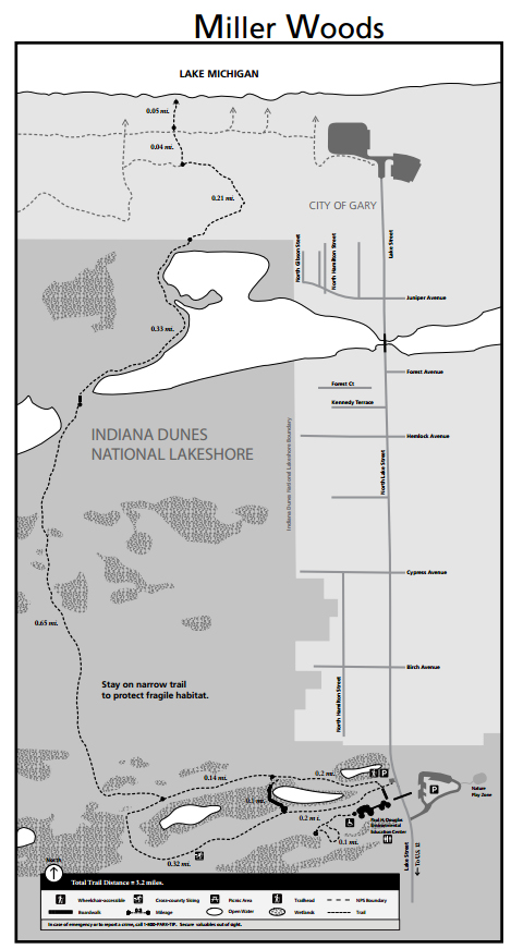
This map is from the National Park Service's PDF of the trails and description of Miller Woods. Click on the
map to open the PDF in a new window.
There are more maps and information about the trails in the National Lakeshore: check out their
site index.
Historic Maps
1900
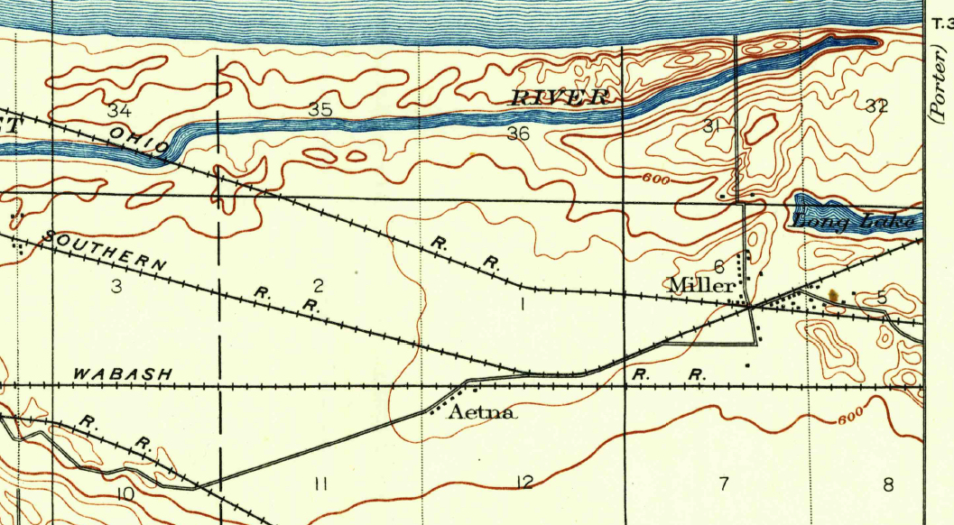
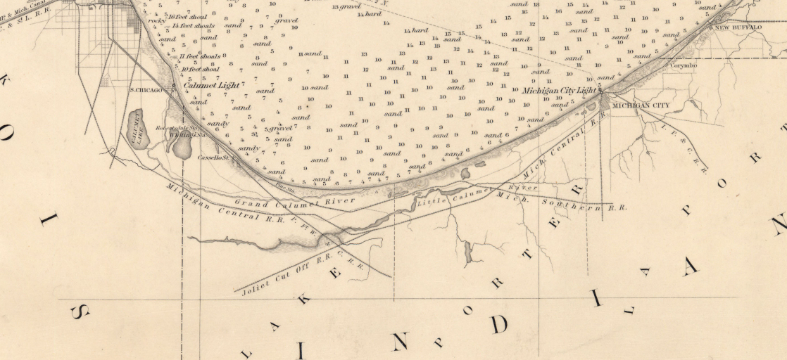
This cool map (click for a larger view) is a section from the 1900 U.S. Geological Survey map. The map is labeled Tolleston, IND and is based on a survey done in 1897. The section that I've cropped shows the county line on the east. The Baltimore and Ohio Railroad tracks (now the CSX tracks) cross the Lake Shore and Michigan Southern tracks at Miller. Those tracks went right down what is now Miller Avenue and were moved north when Gary was built in 1906. More information on the Lake Shore RR are on this page which show some amazing pictures taken in Miller in 1906.
Notice also how far Long Lake extends westward, almost to Lake Street. Also the course of the Calumet River goes almost all the way to the Lake/Porter county line. The mouth of the river is shown only by that little nub, which was about where the north end of Montgomery Street is now. Interestingly, the surveyor did not connect the 'nub' to the lake, but, like the mouth of the Chicago River before it, this land was no doubt a swampy wetland, flowing well in the spring and backing up from the lake depending on the wetness of the seasons.
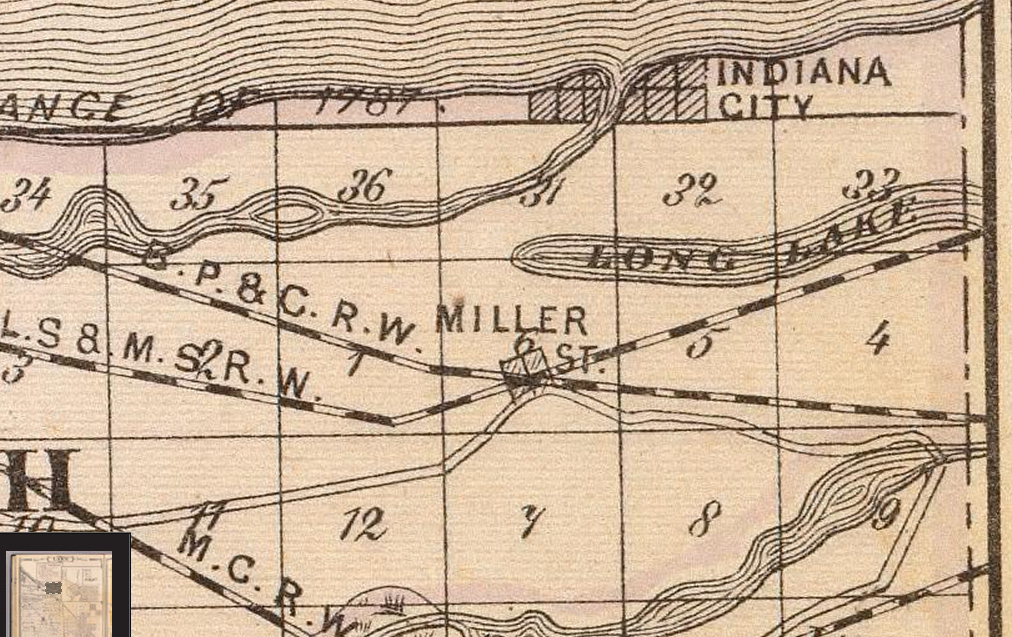
This is an even older map, cropped from the Baskin, Foster & Co. Atlas of 1876 and retrieved from the David Rumsey Map Collection's map of Lake County (with) Lowell, Hobart, Crown Point. It also shows how far Long Lake extends west and indicates the mouth of the Calumet River at the platted, but ill-fated, "Indiana City." This map was drawn five years after the Baltimore & Ohio RR extended it's line to Chicago, crossing the L.S. & M.S.R.W. (Rail Way). That line of rail was opened November 23, 1874 and was officially called the Baltimore, Pittsburg and Chicago, but was soon known as the Chicago division. (Stover, John F. History of the Baltimore and Ohio Railroad. West Lafayette, Ind: Purdue University Press, 1987. Print., page 152)
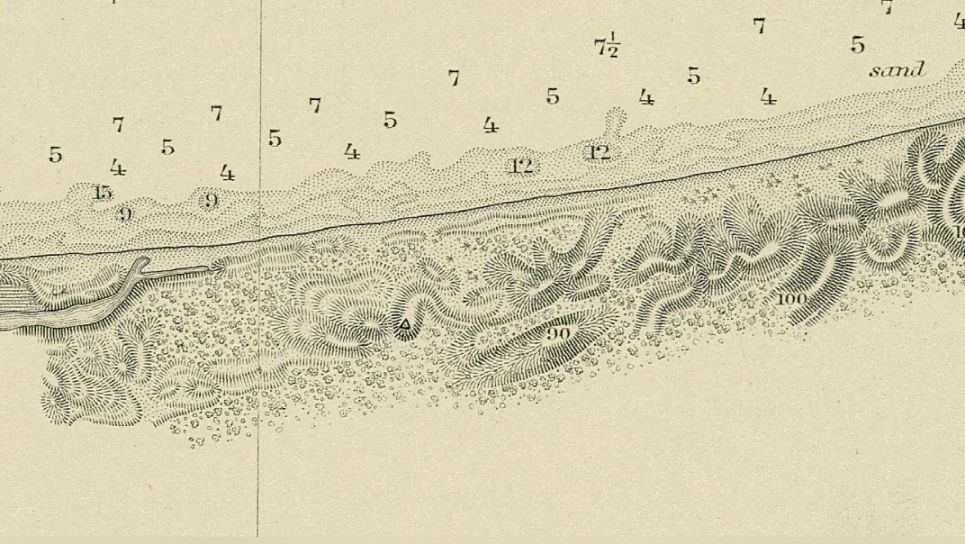
These interesting maps are of the south end of Lake Michigan as it's shoreline was mapped in the 1870s along with the rest of the Great Lakes. These are online in at Wisconsin's Water Library but the introduction to these maps is worth repeating from that website:
"In 1841, Congress created the Lake Survey within the U.S. Army Topographical Engineers, which later became part of the U.S. Army Corps of Engineers. The Survey, based in Detroit, Mich., was charged with conducting a hydrographical survey of the Northern and Northwestern Lakes and preparing and publishing nautical charts and other navigation aids. The Lake Survey published its first charts in 1852. In 1882, after producing 76 charts, it had completed its Congressional mandate."
Thanks to Simine Short for bringing these maps to my attention.
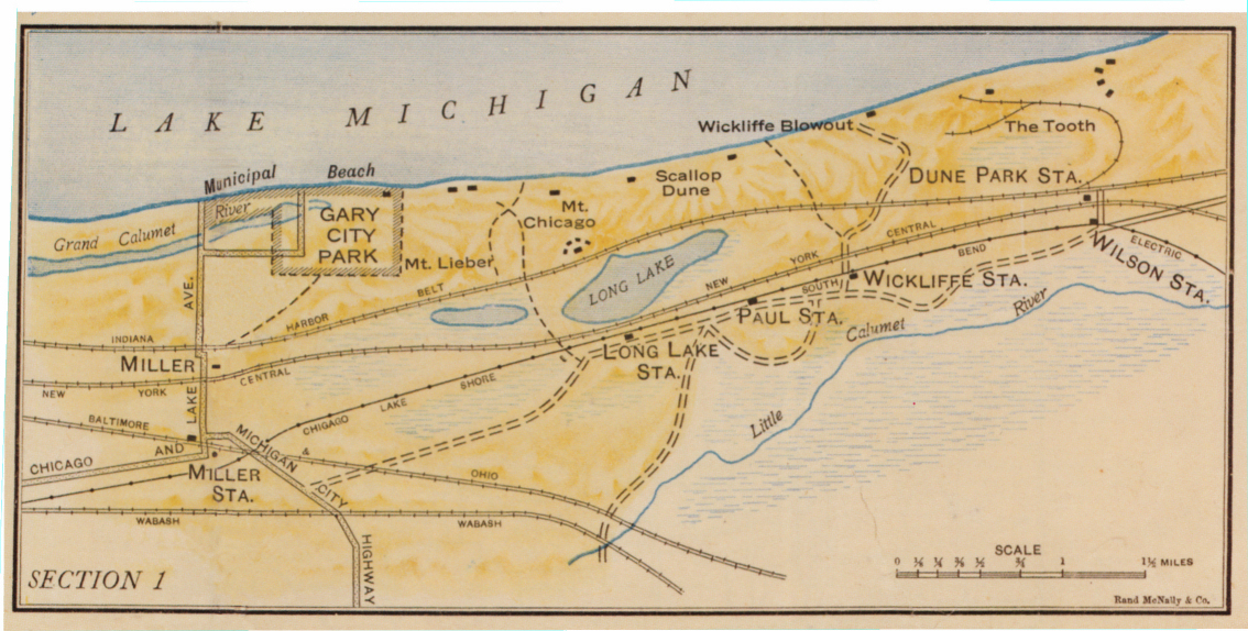
This 1918 map is from The Indiana Dunes Revealed - The Art of Frank V. Dudley in which some maps from Peter S. Goodman's Rand McNally Map of Indiana Dunes are reproduced. Goodman was a member of the Praire Club, and his maps caused some controversy because he gave names to prominent dunes. His maps covered the topography between Miller and Michigan City and he was want to name dunes after prominent people of the day, members of the Praire Club. And there was even a "Diana Dune," named for Diana of the Dunes. In any case, the map "Section 1," shows Miller, a rather shrunken Long Lake, and the proposed road to Michigan City which was to become Highway 12. Old Hobart Road is easily identified, even if named "Michigan City Highway." It also shows the railroads, including the then 12 year old South Shore and it's stop at Dune Park and Wilson Station, both of which are long gone. It was at the Dune Park Station that reporters covering Octave Chanute's experiments came to beat their way to the shore to observe Chanute's flight attempts. Resources:
- Goodman, P S. Rand Mcnally Map of Indiana Dunes: The Wonder Region of the Middle West. Chicago, Ill: Rand McNally & Co, 1918.
- Dudley, Frank V, James R. Dabbert, Richard H. W. Brauer, and Gregg Hertzlieb. The Indiana Dunes Revealed: The Art of Frank V. Dudley. Valparaiso, Ind: Brauer Museum, Valparaiso University, 2006. Print.
- See: Engel, J R. Sacred Sands: The Struggle for Community in the Indiana Dunes. Middletown, Conn: Wesleyan University Press, 1983. Print, pages 46-48.for the history on the maps.
Chanute Related Maps are on their own page: There is a close up of Marquette Park in Miller that shows the location of "Chanute Hill", where Chanute's first experiments of 1896 occurred. This map also shows the original course of the Grand Calumet River and where it emptied into Lake Michigan. The location of First and Second experiments of 1896 is shown on this map.
Updated November 2019 and May, 2022.
Any questions or comments please email Steve Spicer: steve@spicerweb.org