Chanute Hill - Its Location and History

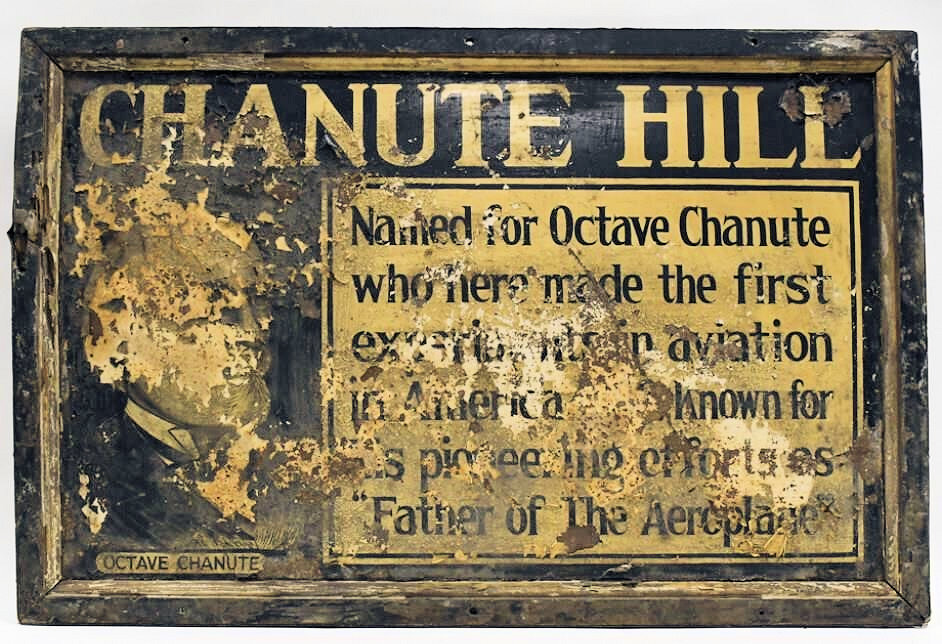
The above unique and degraded sign, made likely in 1936-1937 for an historical site dedication, was sold recently at an online auction. Click on the image to see the sign and its back.
Anyone who has read about Octave Chanute’s 1896 June and early July experiments in Miller has probably wondered where exactly in Miller he camped out and did those experiments with the kite, the Lilienthal “wing glider,” and the multi-winged “Katydid”.
The actual location has been obscured for decades by guesses and the fact that it was removed in the 1920s, but hopefully, drawing on newspaper sources we can put that mystery to rest.
Many thanks to Simine Short for her help with the research and encouragement on this and all the Chanute pages.
Its Location: The Evidence
Certainly, in the first few decades following his experiments, the location was known to locals and called just that, “Chanute Hill.” But the first time that phrase appeared in print that I’ve found was in an article about the flights written by a Hammond Times writer, who interviewed then sixty-year-old William Westergren (1867-1956). The article is rather inaccurate compared to Chanute’s actual record of the experiments, but that was possibly Westergren’s memory or just bad reporting. Nevertheless, the article’s first sub-heading “Chanute Hill Gone,” gives an accurate account of what happened to the big dune:
“Chanute Hill, named after the discoverer by Judge Westergren, has finally given way to the encroachment of civilization, having been torn down by a Gary realtor during the opening of a residential subdivision nearly a year ago. Suggestion has been made that a fitting monument be erected on the former site of Chanute Hill where Doctor Chanute’s first biplane glider, born in the dunes had conquered the air.”
Click the news clipping for the full article.
The article was picked up by the Indianapolis Times and Valparaiso’s Vidette-Messenger within a few days, somewhat edited, but essentially copied. The country was wild about airplanes following Lindbergh’s transatlantic flight in May of 1927. Over the next couple of years “Chanute Hill” was mentioned several times, including an article on Hiking in Indiana in the Chicago Daily News in 1929 that included this:
“Leaving the train at Miller, the walker follows the concrete road in a northerly direction through the village and across the Grand Calumet bridge. Chanute Hill is on the right.”
But perhaps the most descriptive of the location is in a 1936 article in the Gary Post-Tribune when the boulder and plaque commemorating the fiftieth anniversary of the experiments was published. That article, which focused on William Westergren and his pal John Ansboro’s recollections, featured two photos of where the hill had been. In a caption to the photos:
“In the picture at the right above is shown an eastern view, from Lake street, of all that remains of the once high dune from which the Chanute glider experiments were conducted. In the lower photograph is shown a present-day view of the duneland and lake shore over which the first glider flights were made. It was taken by The Post-Tribune photographer from the sand mound forming all that remains of the new historic “Chanute hill,” located at the southeast corner of the Lake and Juniper avenue intersection.”
(The photos are pretty crappy off the microfilm, but if you'd like to see them, and the whole article click here.)
Never mind that Westergren was possibly one of the people partly responsible for removing a large portion of the dune along with his real estate partners, one of whom was Joseph Boo, another Miller resident who was one of the founders of Ogden Dunes in 1923.
“Residential subdivision” is a stretch. Building would not go on for a number of years. In fact, Juniper doesn’t appear on the City Directory until 1929, and then, although there is an absence of Directories between 1930 and 1935, there is one lone house on Juniper in 1935. There are no houses on Henry, Howard or Hancock north of Juniper until the 1952 City Directory which shows one on North Henry and three on N. Hancock, while by 1952 there are four houses on Juniper between N. Hancock and N. Henry.
Whether the original hill was part of a longer ridge that tapered back eastward to where the streets and houses are now is not known, but the hill certainly blocked any development eastward along the north side of the lagoon. Building sites on the lagoon were coveted, and ownership of the land north to the shoreline was still very much contested. While I’ve never been able to determine when the old wooden bridge was replaced, it is quite possible that a lot of the sand of Chanute Hill was used to narrow the ‘throat’ of the river to make the bridge shorter, and cheaper.
Chanute himself had little or nothing to say about the dune other than it was “…a sand hill about thirty feet high…”
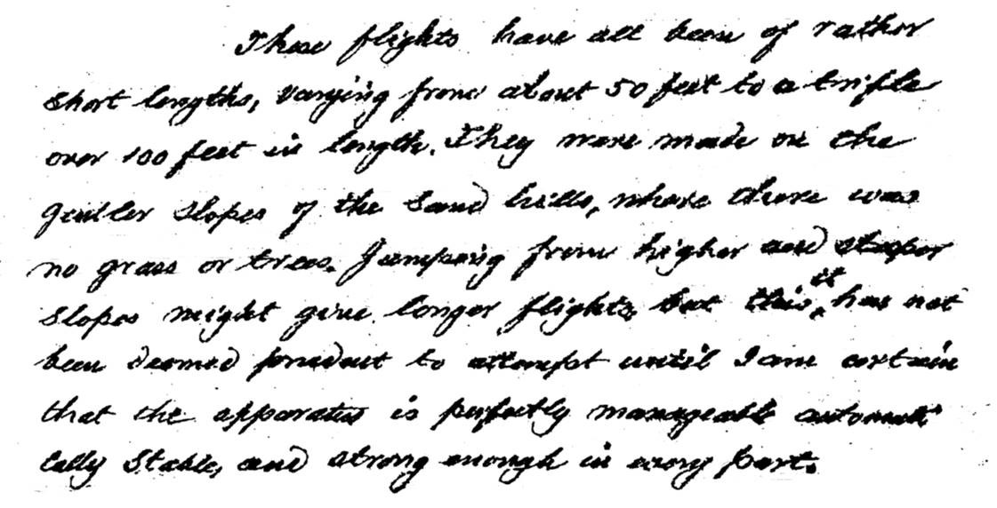
However, in a letter Chanute wrote the day after his return to Chicago he wrote, "These flights have all been of rather short length, varying from about 50 feet to a trifle over 100 feet in length. They were made on the gentler slope of the sand hills, where there was no grass or trees. Jumping from higher and steeper slopes might give longer flights, but this it has not been deemed prudent to attempt until I am certain that the apparatus is perfectly manageable automatically stable, and strong enough in every part."
While this doesn't provide clues to where exactly they performed their experiments, it does give one an idea of the terrain.

Excerpt from Chanute's letter of July 5, 1896
Remarkably, we have a picture of that thirty-foot dune and where it was located that was published in E. Stillman Bailey’s 1917 book The Sand Dunes of Indiana. The picture, which is primarily of the wooden bridge built about 1895-96, shows the dune just over the bridge and to the right as Westergren described it in 1936.
Westergren’s memory, or the reporter’s interviewing, are somewhat in doubt in 1936 when an article states “The first flight was made from a dune about 75 feet high which stood 40 years ago at what is now the southeast corner of the intersection of Lake and Juniper, just north of the Marquette park lagoon, according to Westergren.”
William Westergren goes into detail in that article about how difficult it was to get to the north side of the lagoon, but I suspect his memory was playing tricks with him. The wooden bridge, built prior to Chanute’s lugging tents, gliders, and supplies, was certainly there before he arrived.
The Boulder & Its Plaque
The location of the boulder and plaque just south of the Pavilion in Marquette Park has likely caused a good deal of confusion over the actual location of “Chanute Hill.” According to Simine Short, Chanute’s biographer, the Western Society of Engineers, one of the sponsors of the boulder and plaque, wanted it put at the intersection of Juniper and Lake Street, but the city objected. Westergren was none too pleased with its location, quoted in a 1954 article when he was 87 years old, said, “And another thing, why doesn’t the city put the Chanute memorial boulder where it belongs? It doesn’t belong next to the pavilion in Marquette Park, it belongs up there on the hill at Lake and Juniper where Chanute did his gliding.”
On a blistering hot day in July, dignitaries from around the State and area assembled under tents as U.S. Navy planes cruised overhead. Hammond Times declared “Huge 5-ton Boulder from Glacier Marks Frenchman’s First Flight” on page one of Saturday’s paper.
On the day before the Gary Post-Tribune featured a picture of the boulder and the plaque on page one. And the Chicago Tribune noted the event in Sunday’s paper.
After 86 years residing south of the Pavilion, the boulder was moved to the front of the Aquatorium in July of 2022.
A Map
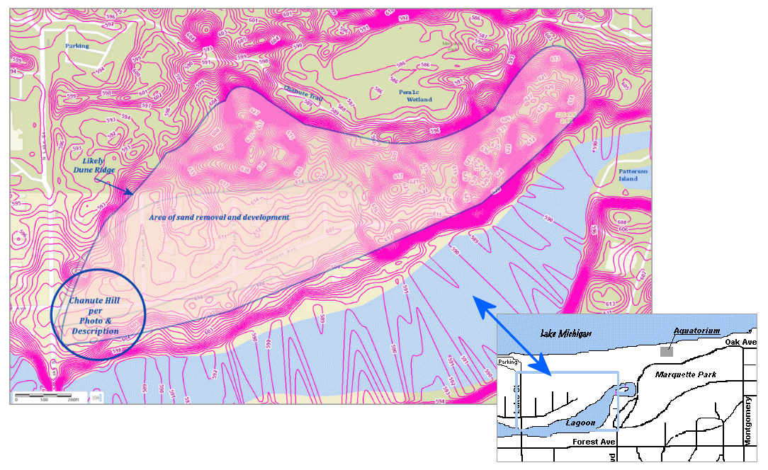
The map below has locations overlayed on a current contour map of the area. Chanute Hill may have been the western edge of a ridge, but given the picture above there was likely a swale, or dip, in the ridge between it and the tall dune to the east. For a map – a slightly bigger area - of just the current contours from the Lake County Surveyor’s GIS website click
here.

Conclusion
While it may be tempting to see the existing tall dune some 240 yards east of Lake Street that overlooks Chanute Trail to be the place where Chanute’s band performed their experiments with the wind, I do believe that there was little reason for them to have made that trek over the dunes when there perfectly adequate dune right at hand at the road with easy access to supplies from the town. That hill was no doubt very similar to the one that still exists with a blow-out on the north side. Given the evidence presented in the fifty years following 1896, I do believe that the actual dune from which Chanute tested the wind with his devices is gone.
Footnotes: