This is a companion page for the Park and Annexation page.
It's not all that easy to picture in your mind when someone says, or writes, that 116½ acres were given to the City by U.S. Steel as was written in the Park / Annexation page. Hopefully these maps will help, with the disclaimer that these are approximate areas, but quite close.
Click on the images to enlarge.
The two images below are from the Lake County Surveyor's GIS site and demonstrate the current size of Marquette Park.
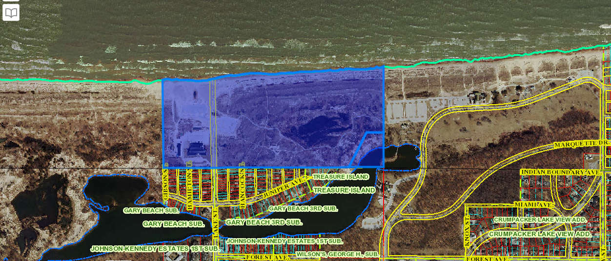
The west section of Marquette Park, not added until the 1940s, is identified on the GIS site as 65.55 acres and 2.88 acres for the small section on the lower right.
To the west is National Park land. The imaginary "Indiana Boundary" line is seen as a small black line extending westward from Indian Boundary Ave.
Below is the full extent of Marquette Park today from the GIS Surveyor's site.
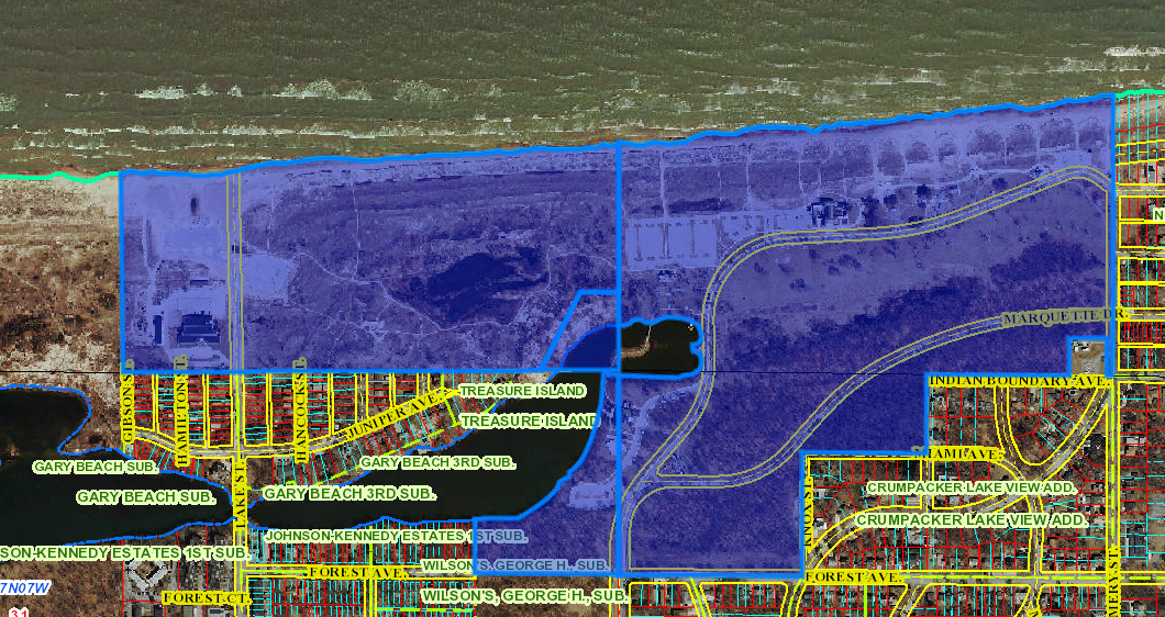
Using the Google Maps Area Calculator I calculated that this is approximately 192 acres.
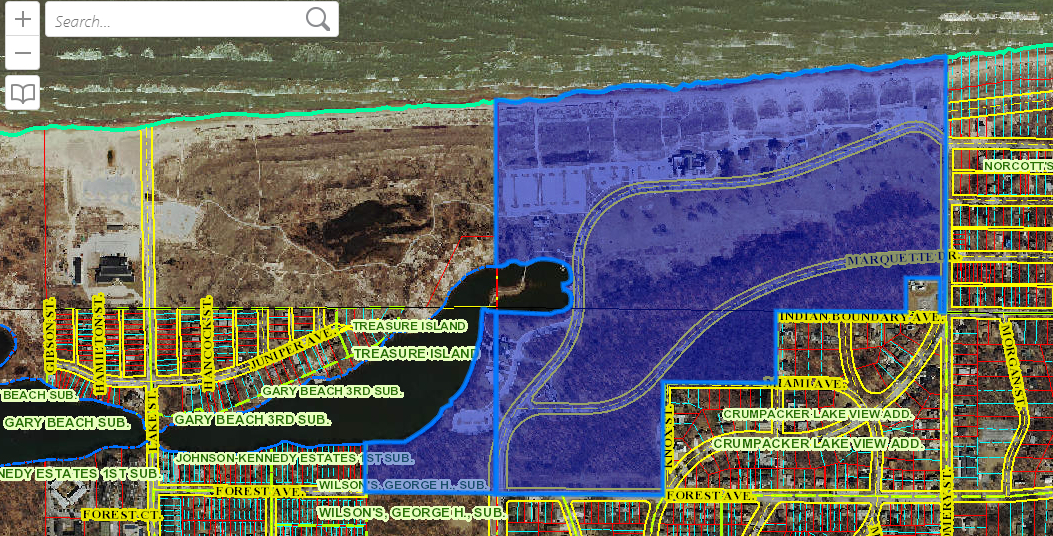
These two parcels are approximately 125 acres. They have no acreage identified on the GIS site, but I've calculated the area using Google Maps Area Calculator Tool
Below is the 1922 concept drawing of Lake Front Park dated 1922.
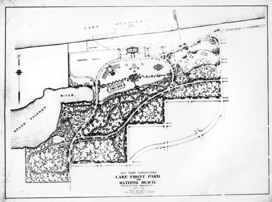
The 1922 concept plan drawing is more than the 116 1/2 acres that U.S. Steel gave to the City at the end of August, 1919, but includes the small section at the southwest corner. Evidently the city acquired that land in the years between 1919 and 1922 for it corresponds with the current GIS map above.
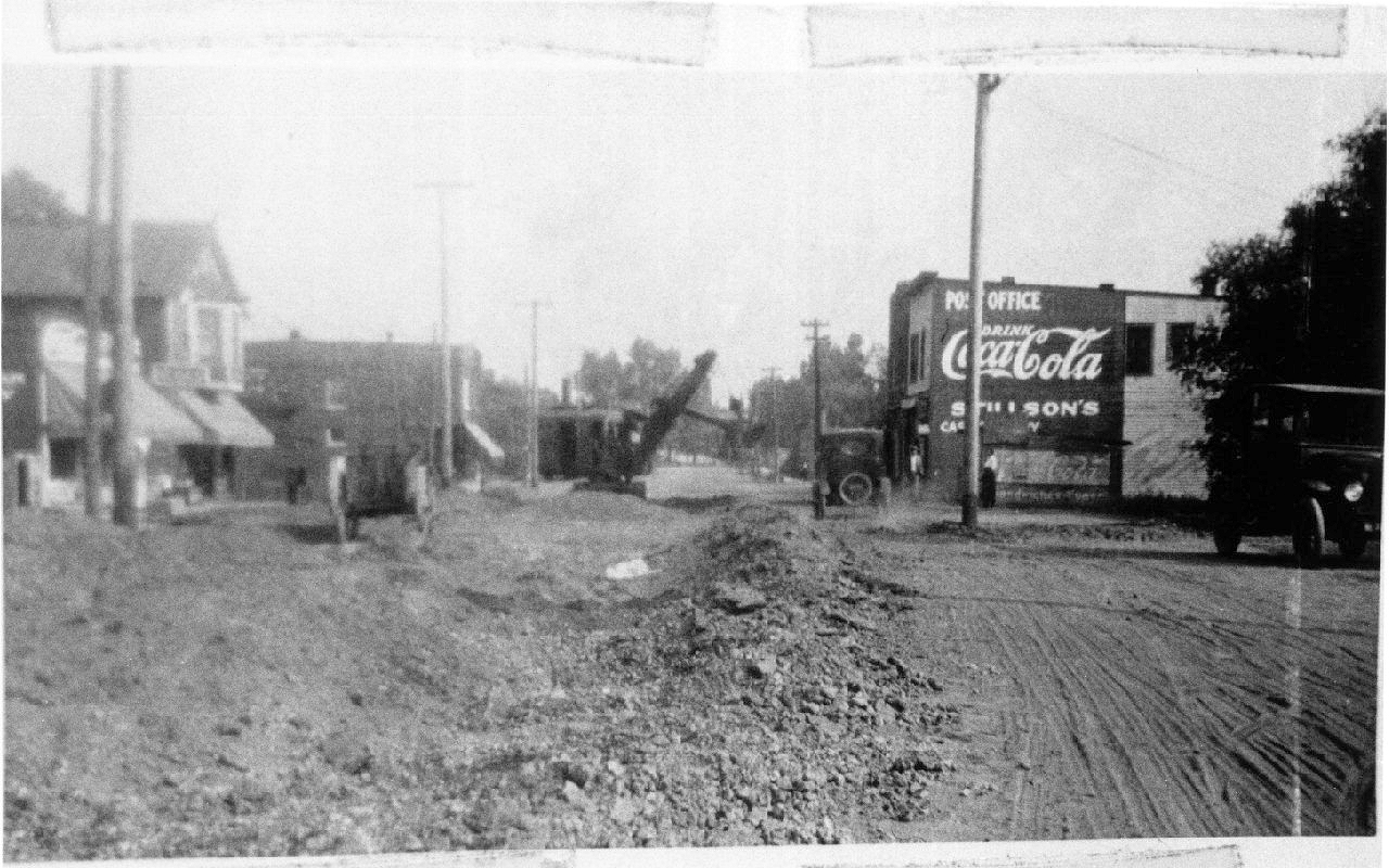
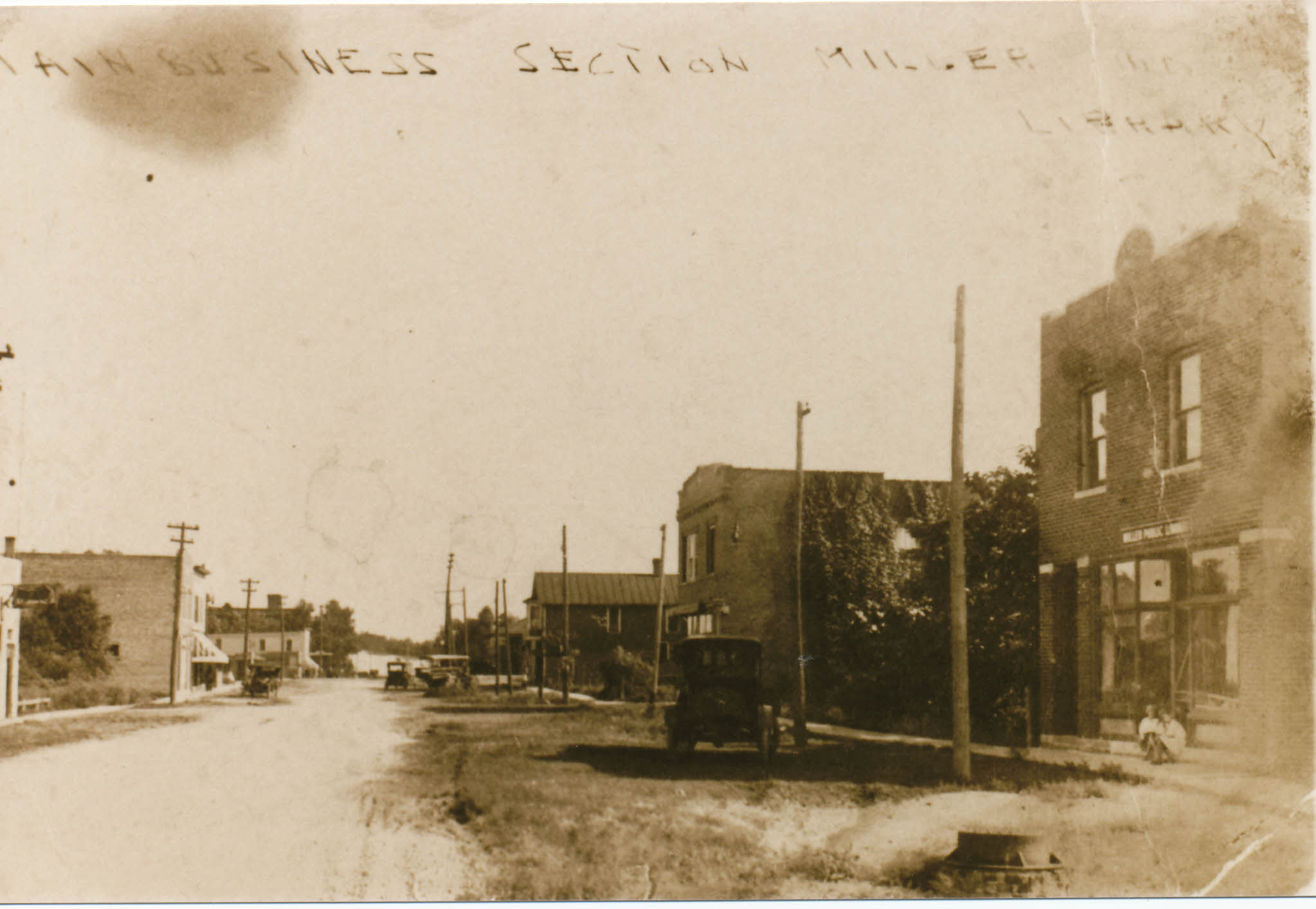
Below are two interesting photos of Lake Street being paved likely in the fall of 1922 to the spring of 1923.
The paving of Lake Street and Forest as well as repairing Grand Boulevard were important to Marquette Park since when it was opened in 1922 there really was no good road to the park, or to Lake Street beach either.
I confess to not really being able to figure out these two photos except that they were obviously taken when
Lake Street was being first paved. I believe they are both looking north. Both the 1925 and 1927 city directories put the library, in the
right photo, about two blocks north of Miller Avenue at 548 Lake Street.
In 1925 the post office was at 637 Lake Street between 6th Place, the tracks and Miller Ave.
It was likely that in the post office was in Stillson's grocery in 1923, the grocery being at 617 Lake Street.